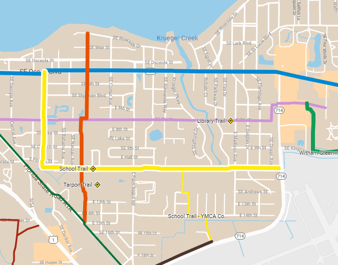
Route List
Many route options exist – these are a proposed list based on observed popular routes/destinations, use existing easy-to-build right-of-ways and publicly owned land, and maximum opportunity for safety and shade.
It it neither definitive nor complete – but demonstrates one vision for a safe and connected Stuart that we believe is quickly implementable, equitable, and achievable.
All Ages Routes:
Ocean Trail *
School Trail
Library Trail
Tarpon Trail
Palm City Road
Witham Greenway
Mixed Abilities Routes:
East Coast Greenway *
Willoughby Connector
Baker Road *
Central Parkway
Pedestrian Routes:
Sailfish Healthy Trail
* Indicates route controlled by Florida Department of Transpiration (FDOT). All other routes use primarily local roads or public lands
Trail Map
Click for a larger scale map or to open in the Google Maps App.
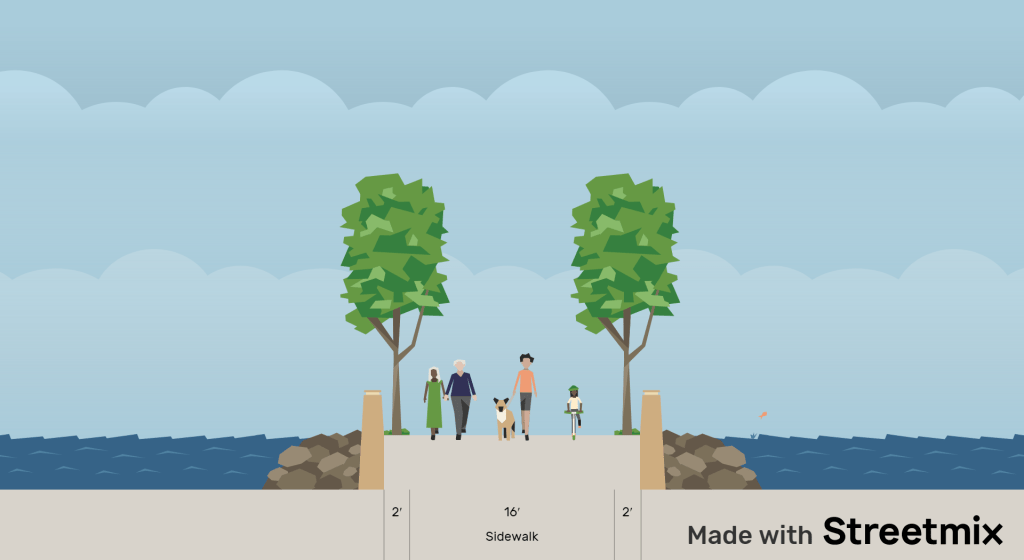
Ocean Trail
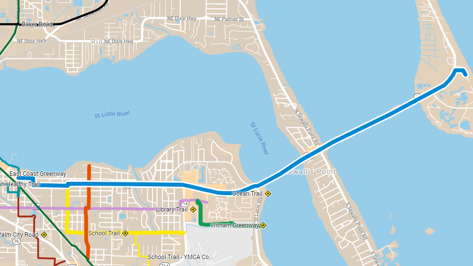
Route:
Downtown to Stuart Beach
Length:
5.25 miles
Type:
All ages multi-use trail
This trail will be a multi-use trail along Ocean Blvd and across the bridges to the beach.
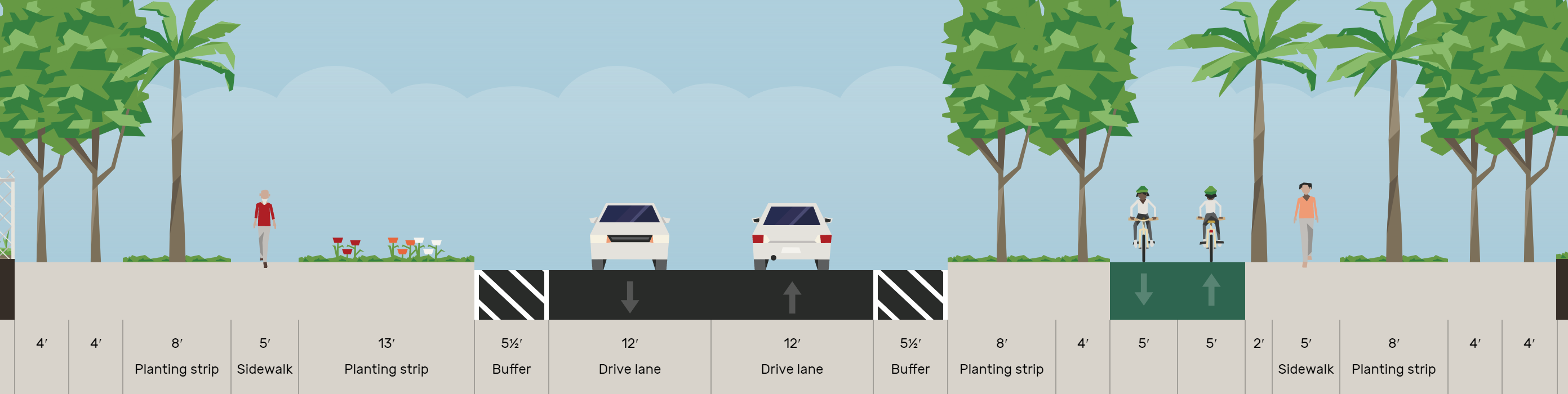
Ocean Trail: Memorial Park to Palm Beach Rd
The trail will begin on Osceola St downtown and continue in open space available along Ocean Blvd in Memorial Park, in front of the Middle School, and at the old High School.
Ocean Trail: Palm Beach Rd to St Lucie River
At High School Ave (at the intersection of the School Trail), the trail can cross Ocean Ave and continue East.
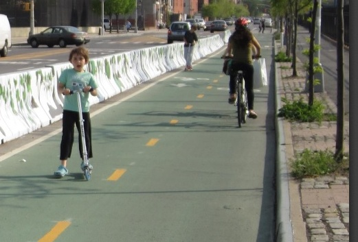
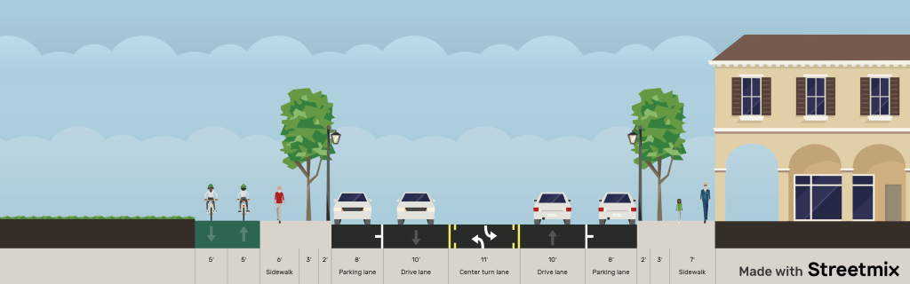
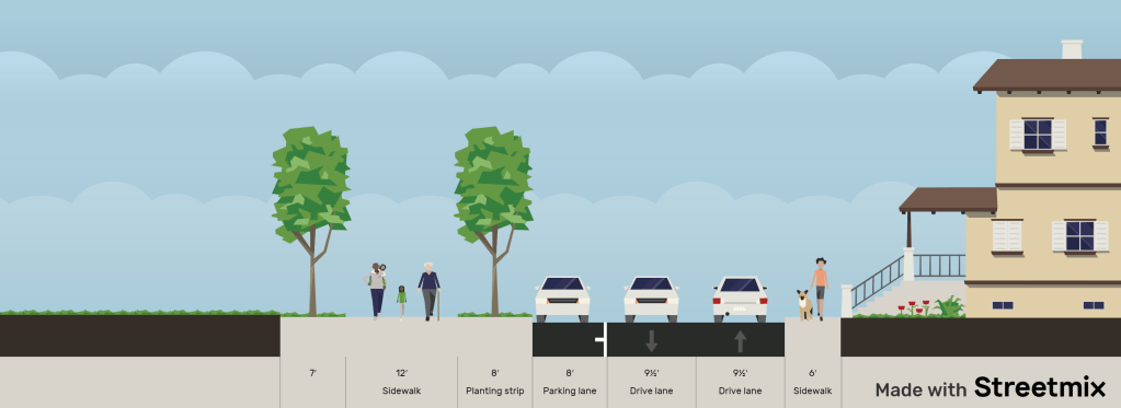
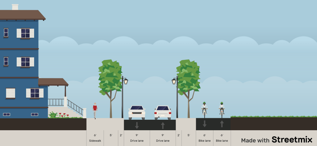
While a lane diet study is conducted for Ocean Ave East of Palm Beach, we propose a quick-build solution of narrowing the lanes and adding a protected multi-directional trail along the North side. This route is continuously used by people walking and biking, but they currently experience unsafe conditions.
Long term, a streetscape modernization project can elevate the trail, and potentially perform a lane diet. With the trail on the North away from the powerlines, shade trees can be added to protect from the southern sun exposure.
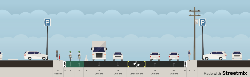
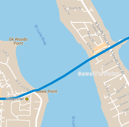
Ocean Trail: Sewells Point Bridge
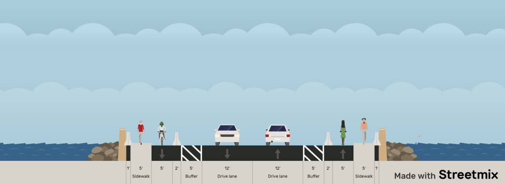
As the trail reaches the Sewells Point bridge, excess shoulder area can be reallocated to enhance safety for all road users. This is in compliance with FDOT’s modern best practice and should be implemented immediately to provide better physical protections for both people walking and biking. In addition, it should help reduce dangerous speeding on the bridge.
Long term, traffic counts and hurricane evacuation guidance suggest that parts of the bridge could potentially be reduced one lane to allow for signature amenities on top of the bridge (palm trees, shade structures, picnic tables, etc).
Ocean Trail: Hutchinson Island Bridge
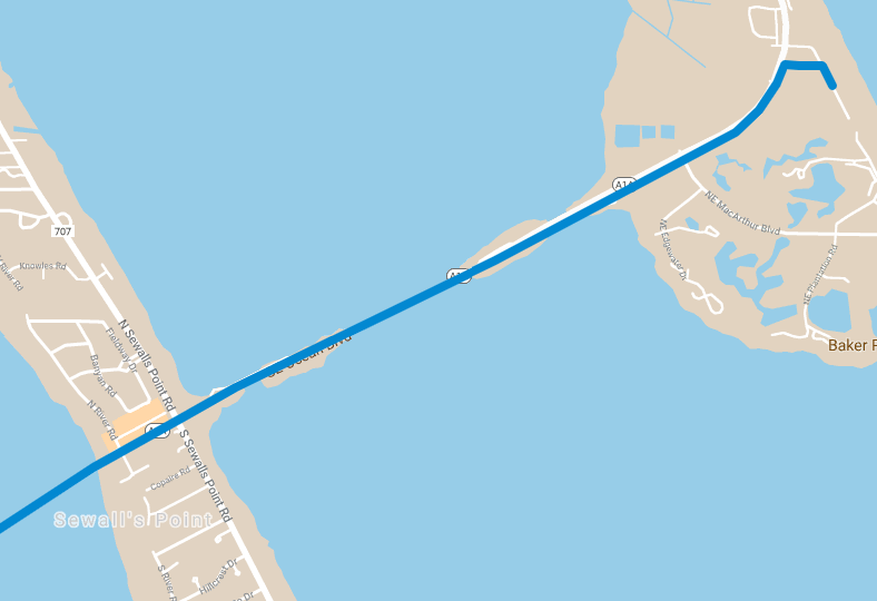
As the trail continues East across Sewells Point, a similar quick-build can continue until the two-lane bridge to Hutchinson Island. Since the bridge to Hutchinson Island is narrower, FDOT guidance will likely only allow enough room for a one-way path along each side and still leave enough room for emergency vehicle access. Therefore, a safe way to cross the road should be added at either end of the bridge – pedestrian access should be added to the eastern Stuart Causeway park should be added on Hutchinson Island. Long term, the traffic light on Sewells Point could be upgraded to a modern protected roundabout.
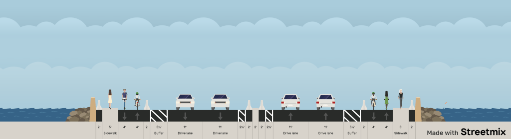
Ocean Trail: Hutchinson Island / Stuart Beach
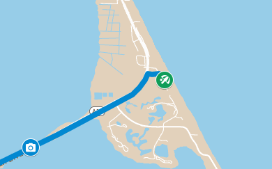
From there, the sidewalk on the South side of Ocean could be widened to a multi-use trail, terminating at Stuart Beach. This would provide an quick-build low-cost and safe route for thousands of our region’s residents and visitors to get from home to their place work or play.
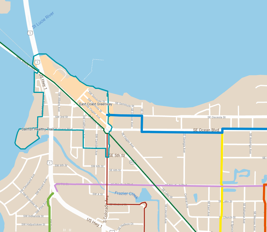
School Trail
Route:
Ocean Blvd to Monterey with spur to YMCA
Length:
1.75 miles
Type:
All ages multi-use trail
The route connects children to 7 schools and 4 community centers across our town.
School Trail: High School Ave
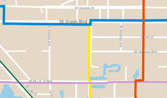
Starting at Ocean adjacent to the old High School, near Stuart Middle School, and passing beside the new Boys and Girls Club near MLK.
School Trail: Bridge at MLK
Long term bridge or path around pond.
Location of New Boy’s and Girls Club
Short term / immediate option using unused school board land (around drainage pond access)
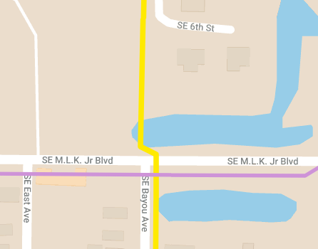
School Trail: Bayou Ave Shared Space
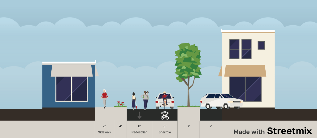
South of MLK, the Trail continues as a separated path on city and housing authority land until it reaches Church Street. South of Church St, there is limited right-of-way, so we propose the Bayou Ave Shared Block. This type of shared space is also referred to as a Woonerf or Play Street, depending on jurisdiction.
Leaves parking for Mt Calvary Baptist Church

School Trail: 10th and Guy Davis
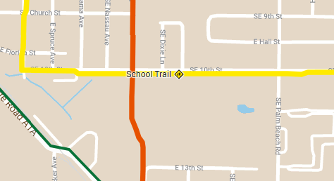
10th st, along Guy Davis Park
10th st at JD Parker Elementary / St. Joseph’s, etc
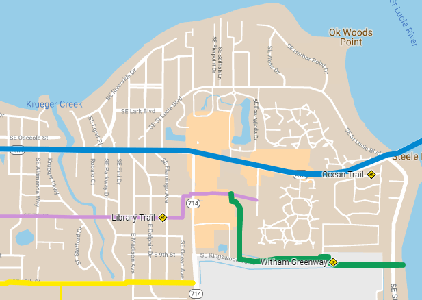
Library Trail
Detailed route descriptions are being worked on. Please see the map above for suggested route information.
